


Satellite Hardware


The satellite communication hardwares of CGSTL mainly consist of satellite products, CubeSat platform, satellite cameras, standalone products, and components products.
SATELLITE INTERNET HARDWARE LIST
Satellite Products
Cubesat Platform
Satellite Cameras
Satellite Standalone Product
Satellite Components Product
Satellite Services
Satellite Manufacturing Product
Satellite Internet Hardware
Satellite Products
Cubesat Platform
Satellite Cameras
Satellite Standalone Product
Satellite Components Product
Testing Services
FUNCTIONALITY OF JL1 SATELLITE HARDWARE FOR EARTH OBSERVATION
satellite hardware
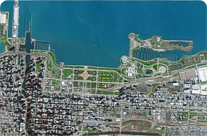
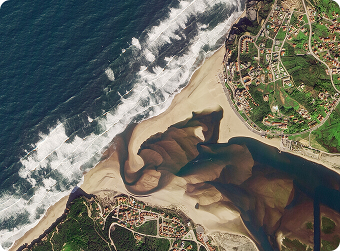
GF Satellites with a Resolution of 1m
GF satellites with a resolution of 1m are the new generation optical remote sensing satellites independently researched and developed by the Company. These satellites are designed with light weighted structure, highly integrated electronics system, high-resolution ultra-light weighted camera and other innovative technologies. These satellites have the features of low cost, low power consumption, lightweight and high resolution.
FUNCTIONALITY OF JL1 SATELLITE HARDWARE FOR EARTH OBSERVATION
satellite hardware
GF Satellites with a Resolution of 1m
GF satellites with a resolution of 1m are the new generation optical remote sensing satellites
independently researched and developed by the Company. These satellites are designed with light weighted structure, highly integrated electronics system, high-resolution ultra-light weighted camera and other innovative technologies. These satellites have the features of low cost, low power consumption, lightweight and high resolution.
satellite communication hardware
SP Satellites with a Resolution of 1m
SP satellites with a resolution of 1m have area array video imaging functions, and they have the features of low cost, low power consumption, lightweight and high resolution.
satellite internet hardware
12U CubeSat Platform
12U CubeSat platform is the new generation effective 12U high-performance multi-load cubic volume. The satellite flies in the SSO orbit of 500km high, the remote sensing images whose resolution is superior to 1.35m can be obtained. The satellite adopts the concept of cubic satellite standardization and modular d`esign, and features low R&D cost, short development cycle, strong carrying capacity and high reliability. It is suitable for ground observation, new technology verification, scientific detection, biological testing and other fields.
cubesat hardware
2m-resolution Micro-nano Camera
2m-resolution micro-nano camera is one of the core parts of earth observation satellites. It can be used for CubeSat. The camera has the advantages of small volume, light weight and high resolution, etc., and it can be used in the fields of vegetation classification, crop yield estimation, pest control, geomorphic observation and water quality measurement, etc.
As a satellite supplier, we can offer sorts of commercial satellitefor sale, if you are interested, please leave us a message.
在线联系供应商
Other supplier products
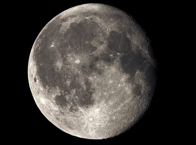 |
LUNAR SATELLITE IMAGES | Jilin 1satellites can not only capture the images of the earth, but they can also turn the cameras to photograph space objects, such as the space s... |
 |
PUSH BROOM SCANNING SERVICE | The massive imagery archieved data and task programming data that cover all over the world captured by JL1constellation. Great view and great detai... |
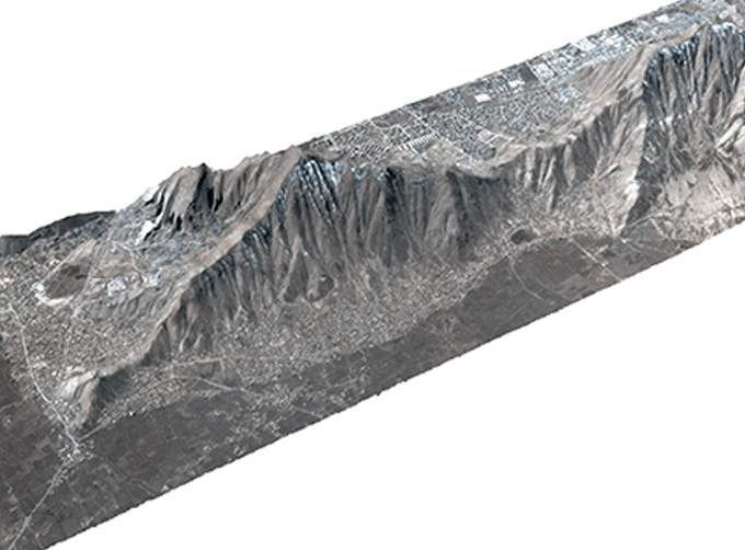 |
STEREO SATELLITE DATA | The data of SP or GF satellites of JL1 constellection can be used as stereoscopic mapping to produce DSM results with resolution better than 1m. ... |
 |
SATELLITE GROUND SYSTEMS | The mission of the ground satellitesystem is to track, measure and control the earth resources satellite, implement functional management, and rece... |
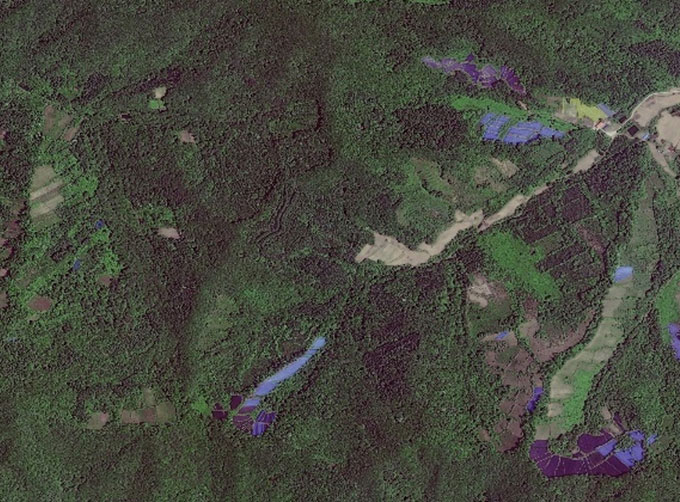 |
GREENBELT SATELLITE REMOTE SENSING | Greenbelt grass remote sensingis a technology that is used to detect and analyze the type distribution and biomass of grassland resources. Jilin... |
Same products
 |
PHOTOGRAMMETRY REMOTE SENSING | 卖方: Chang Guang Satellite Technology Co., Ltd. | Photogrammetry remote sensingis to obtain reliable information about the earth, its environment a... |
 |
MARINE REMOTE SENSING | 卖方: Chang Guang Satellite Technology Co., Ltd. | MARINE REMOTE SENSING Ocean colour remote sensingrefers to remote sensing that takes the ocean a... |
 |
NIGHT SATELLITE IMAGE | 卖方: Chang Guang Satellite Technology Co., Ltd. | The SP and GF03C satellites of JL1 constellection can conduct fast shooting with high-resolutions... |
 |
MULTISPECTRAL IMAGES IN REMOTE SENSING | 卖方: Chang Guang Satellite Technology Co., Ltd. | Multispectral remote sensing refers to the multispectral data remote sensingtechnology that divid... |
 |
MULTI SPECTRAL IMAGERY | 卖方: Chang Guang Satellite Technology Co., Ltd. | The GP satellites of JL1 constellection have 26 spectral channels, covering optical remote sensin... |


