
GREENBELT SATELLITE REMOTE SENSING


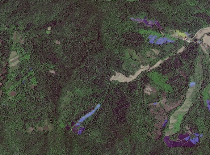
grass remote sensingis a technology that is used to detect and analyze the type distribution and biomass of grassland resources.
Changguang, as an excellent satellite company, offers a wide range of satellite for you to choose from.
Отправить запрос, связаться с поставщиком
Другие товары поставщика
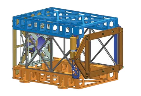 |
SATELLITE COMPONENTS PRODUCT | Cubesat Componentsand Satellite ComponentsProduct It is used for mechanical connection between each single machine and satellite. Satellite -... |
 |
SATELLITE IMAGE MONITORING | Change remote sensing monitoringuses multi-temporal remote sensing data, a variety of image processing and pattern recognition methods to extract c... |
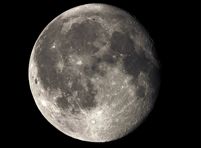 |
LUNAR SATELLITE IMAGES | Jilin 1satellites can not only capture the images of the earth, but they can also turn the cameras to photograph space objects, such as the space s... |
 |
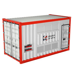
Satellites Testing Services | The satellite communication testing services of CGSTL mainly consist of optical manufacture, satellite testing, and customized service. CHANGGUA... |
 |
LUNAR SATELLITE IMAGES | Jilin 1satellites can not only capture the images of the earth, but they can also turn the cameras to photograph space objects, such as the space s... |
Похожие товары
 |
PHOTOGRAMMETRY REMOTE SENSING | Продавец: Chang Guang Satellite Technology Co., Ltd. | Photogrammetry remote sensingis to obtain reliable information about the earth, its environment a... |
 |
MARINE REMOTE SENSING | Продавец: Chang Guang Satellite Technology Co., Ltd. | MARINE REMOTE SENSING Ocean colour remote sensingrefers to remote sensing that takes the ocean a... |
 |
NIGHT SATELLITE IMAGE | Продавец: Chang Guang Satellite Technology Co., Ltd. | The SP and GF03C satellites of JL1 constellection can conduct fast shooting with high-resolutions... |
 |
MULTISPECTRAL IMAGES IN REMOTE SENSING | Продавец: Chang Guang Satellite Technology Co., Ltd. | Multispectral remote sensing refers to the multispectral data remote sensingtechnology that divid... |
 |
MULTI SPECTRAL IMAGERY | Продавец: Chang Guang Satellite Technology Co., Ltd. | The GP satellites of JL1 constellection have 26 spectral channels, covering optical remote sensin... |