

GREENBELT SATELLITE REMOTE SENSING


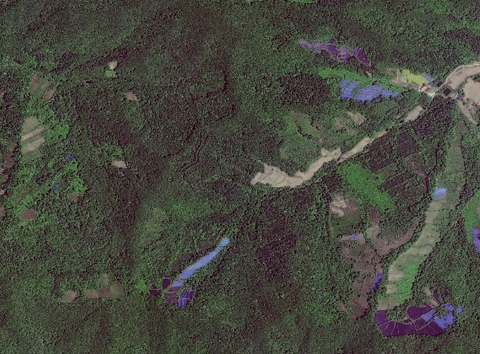
Greenbelt grass remote sensingis a technology that is used to detect and analyze the type distribution and biomass of grassland resources.
Jilin satellitefounded on December 1st, 2014, it's a unique commercial aerospace enterprise with the development and operation of satellite research, management as well as remote sensing information processing all in one. With a total registered capital of 1.97 billion RMB, the company comprises Jilin Provincial Government, Changchun Institute of Optics, Fine Mechanics and Physics (CIOMP), social capital, and technical backbone.
As one of satellite service providers, we will do our best to meet all the needs of customers.
Send product request
Other supplier products
 |
INSURANCE SATELLITE REMOTE SENSING | Combining satellite remote sensing technologies with rights confirmation data and land parcel segmentation technology can vectorize and spatialize ... |
 |
PUSH BROOM SCANNING SERVICE | The massive imagery archieved data and task programming data that cover all over the world captured by JL1constellation. Great view and great detai... |
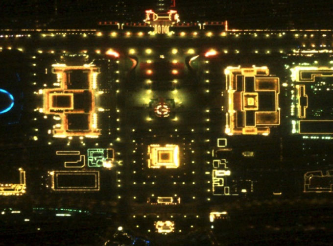 |
NIGHT SATELLITE IMAGE | Satellite View of Earth at Night The SP and GF03C satellites of JL1 constellection can conduct fast shooting with high-resolutions and multispectr... |
 |
SATELLITE REMOTE SENSING IN AGRICULTURE | Satellite remote sensing in agriculturerefers to the comprehensive technology of agricultural applications such as using agriculture satellite tech... |
 |
SATELLITE IMAGE VIDEO | Satellite Image Video The SP, GF03C and MF satellites of JL1 constellection can gaze at a single target point for 120 seconds at most to record ... |
Same products
 |
PHOTOGRAMMETRY REMOTE SENSING | Seller: Chang Guang Satellite Technology Co., Ltd. | Photogrammetry remote sensingis to obtain reliable information about the earth, its environment a... |
 |
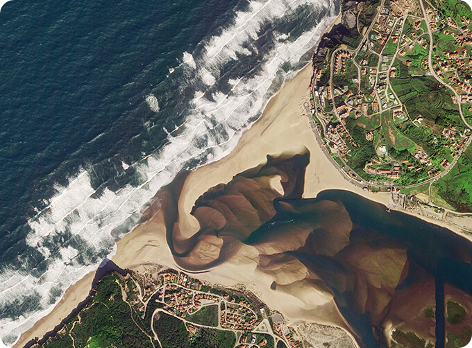
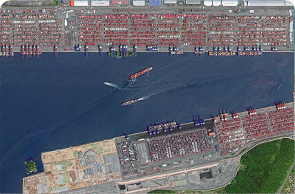
MARINE REMOTE SENSING | Seller: Chang Guang Satellite Technology Co., Ltd. | MARINE REMOTE SENSING Ocean colour remote sensingrefers to remote sensing that takes the ocean a... |
 |
NIGHT SATELLITE IMAGE | Seller: Chang Guang Satellite Technology Co., Ltd. | The SP and GF03C satellites of JL1 constellection can conduct fast shooting with high-resolutions... |
 |
MULTISPECTRAL IMAGES IN REMOTE SENSING | Seller: Chang Guang Satellite Technology Co., Ltd. | Multispectral remote sensing refers to the multispectral data remote sensingtechnology that divid... |
 |
MULTI SPECTRAL IMAGERY | Seller: Chang Guang Satellite Technology Co., Ltd. | The GP satellites of JL1 constellection have 26 spectral channels, covering optical remote sensin... |