SATELLITE REMOTE SENSING IN AGRICULTURE


SATELLITE REMOTE SENSING IN AGRICULTURE
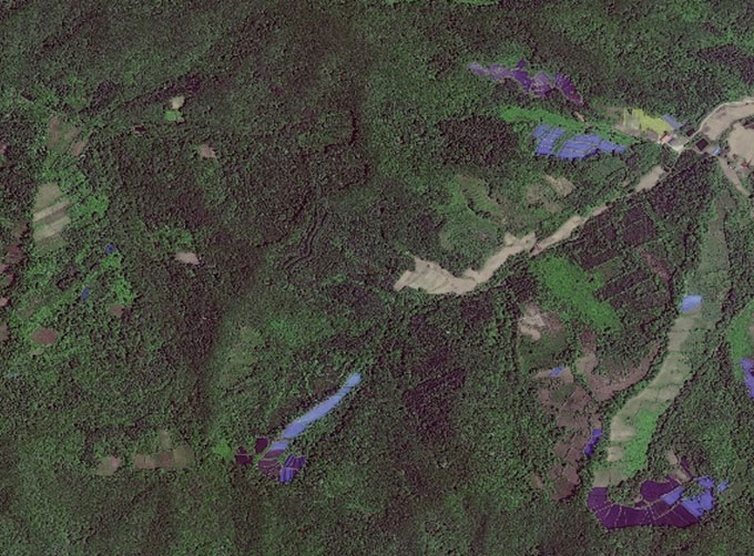
Agricultural remote sensing refers to the comprehensive technology of agricultural applications such as using remote sensing technology to investigate agricultural resources, analyzing land using status, monitoring agricultural pests and diseases, as well as estimating crop yields.
CONTENT OF AGRICULTURAL REMOTE SENSING SERVICE PRODUCT SYSTEM OF CGSTL
|
Product name |
Service frequency |
|
|
1 |
Distribution of cultivated land resources and agricultural facilities |
Once a year |
|
2 |
Crop planting structure monitoring |
Once/crop season |
|
3 |
Crop growth monitoring |
Once/ten days |
|
4 |
Farmland soil moisture and crop drought monitoring |
Once/ten days |
|
5 |
Agricultural disaster monitoring |
On demand |
|
6 |
Crop yield prediction |
Once/crop season |
If you want to know more about satellite imagery in agriculture, please visit our website.
As a satellite company, we can provide sorts of satellite data systemfor clients, anything you need, please leave us a message.
Отправить запрос, связаться с поставщиком
Другие товары поставщика
 |
CUBESAT PLATFORM | Cubesat for Sale The cube satellite platform can provide carrying services for the user's payload. 12U Cubesat Platform Non-standard 6U Cubesat... |
 |
JL1 Satellite Manufacturing Product | Based on "the integration of satellite-borne" and other core technologies, CGSTL has set up the commercial business dealing with the development an... |
 |
GREENBELT SATELLITE REMOTE SENSING | grass remote sensingis a technology that is used to detect and analyze the type distribution and biomass of grassland resources. Changguang, as ... |
 |
SATELLITE IMAGE VIDEO | Satellite Image Video The SP, GF03C and MF satellites of JL1 constellection can gaze at a single target point for 120 seconds at most to record ... |
 |
SATELLITE GROUND SYSTEMS | The mission of the ground satellitesystem is to track, measure and control the earth resources satellite, implement functional management, and rece... |
Похожие товары
 |
PHOTOGRAMMETRY REMOTE SENSING | Продавец: Chang Guang Satellite Technology Co., Ltd. | Photogrammetry remote sensingis to obtain reliable information about the earth, its environment a... |
 |
MARINE REMOTE SENSING | Продавец: Chang Guang Satellite Technology Co., Ltd. | MARINE REMOTE SENSING Ocean colour remote sensingrefers to remote sensing that takes the ocean a... |
 |
NIGHT SATELLITE IMAGE | Продавец: Chang Guang Satellite Technology Co., Ltd. | The SP and GF03C satellites of JL1 constellection can conduct fast shooting with high-resolutions... |
 |
MULTISPECTRAL IMAGES IN REMOTE SENSING | Продавец: Chang Guang Satellite Technology Co., Ltd. | Multispectral remote sensing refers to the multispectral data remote sensingtechnology that divid... |
 |
MULTI SPECTRAL IMAGERY | Продавец: Chang Guang Satellite Technology Co., Ltd. | The GP satellites of JL1 constellection have 26 spectral channels, covering optical remote sensin... |