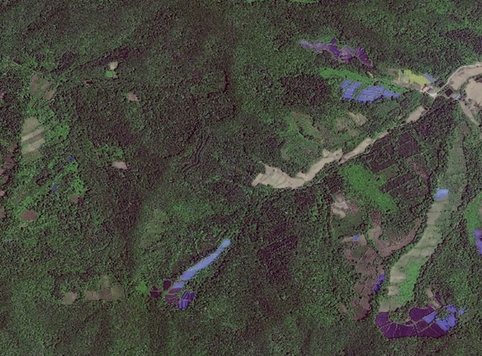
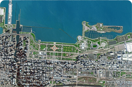
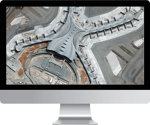
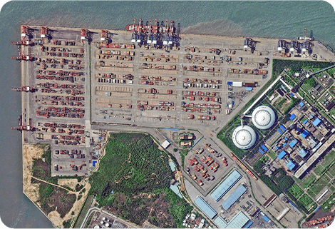
SATELLITE IMAGE MONITORING

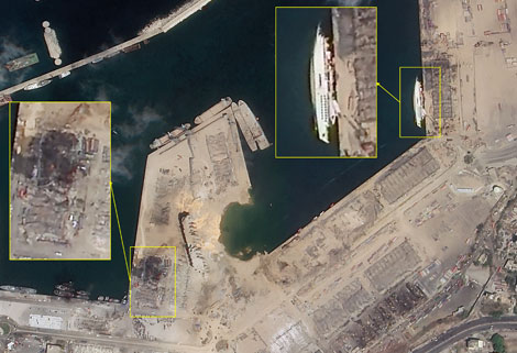
Change remote sensing monitoringuses multi-temporal remote sensing data, a variety of image processing and pattern recognition methods to extract change information, quantitatively analyze and determine the characteristics and processes of surface changes.
CONTENT OF HIGH-RESOLUTION REMOTE SENSING CHANGE MONITORING SERVICE PRODUCT OF CGSTL
|
Product name |
Service content |
Service frequency |
|
|
1 |
Remote sensing monitoring and supervision of "two violations" rectification |
The whole process management of illegal construction as well as illegal map, including upload, verification, classified disposal, distribution and rectification. |
Once a month (or customized in key areas) |
|
2 |
Remote sensing monitoring of urban land use change |
Quick identification of the location and area information of urban land use change map based on intelligent change detection algorithm. |
Once a month |
|
3 |
Remote sensing monitoring of "four chaos" in rivers and lakes |
Remote sensing monitoring is carried out for the "four chaos" behaviors such as random construction, occupation, stacking and mining in the River and Lake Reserve, so as to achieve the effective tracking of the "four chaos" behaviors. |
Once a month |
|
4 |
Remote sensing monitoring in building stage of construction project |
Monitoring the building stage of construction projects objectively to provide decision-making and management basis for statistical investigation departments. |
Once a month (or customized in key areas) |
Chang GuangSatellite Technology Co., Ltd. is a satellite factory, we provide earth monitoring satellites, satellite image monitoring, monitoring satellite, satellite ozone monitoring, volcano satellite monitoring, remote sensing satelliteetc. For more information, please feel free to contact us!
Отправить запрос, связаться с поставщиком
Другие товары поставщика
 |
MULTI SPECTRAL IMAGERY | Multispectral Image Data The GP satellites of JL1 constellection have 26 spectral channels, covering optical remote sensing data from visible ligh... |
 |
GREENBELT SATELLITE REMOTE SENSING | grass remote sensingis a technology that is used to detect and analyze the type distribution and biomass of grassland resources. Changguang, as ... |
 |
Satellite Hardware | The satellite communication hardwares of CGSTL mainly consist of satellite products, CubeSat platform, satellite cameras, standalone products, and ... |
 |
Satellite Hardware | The satellite communication hardwares of CGSTL mainly consist of satellite products, CubeSat platform, satellite cameras, standalone products, and ... |
 |
Services | Bioanalytical Service Bioanalytical Service for Small Molecule Drugs and Metabolites, Large Molecules – Peptides and Proteins, etc. LCMSMS Q... |
Похожие товары
 |
JL1 Satellite Manufacturing Product | Продавец: Chang Guang Satellite Technology Co., Ltd. | Based on "the integration of satellite-borne" and other core technologies, CGSTL has set up the c... |
 |
Satellites Testing Services | Продавец: Chang Guang Satellite Technology Co., Ltd. | The satellite communication testing services of CGSTL mainly consist of optical manufacture, sate... |
 |
SATELLITE TESTING SERVICE | Продавец: Chang Guang Satellite Technology Co., Ltd. | A key test satelliteprocedure in qualifying a satellite for launch. Component-level Thermal-vacu... |
 |
JL1 Satellite Services | Продавец: Chang Guang Satellite Technology Co., Ltd. | The technical index and function mode in terms of satellites research are taking the leading posi... |
 |
Satellites Data Service | Продавец: Chang Guang Satellite Technology Co., Ltd. | At present, JL1 constellation has 72 on-orbit satellites in space and more than 5,000,000 square ... |