


SATELLITE IMAGE VIDEO


Satellite Image Video
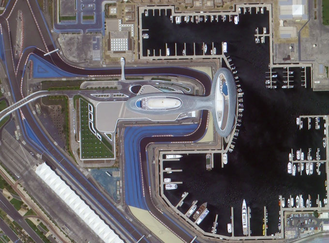
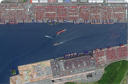
The SP, GF03C and MF satellites of JL1 constellection can gaze at a single target point for 120 seconds at most to record the instantaneous changes of ground objects.
FeaturesofLive Satellite Video of Earth
1
Track the target.
2
Record the track and analyze the situation.
SATELLITE IMAGE VIDEO PARAMETERS
Indicators
Parameter
SP03
SP04-08
GF03C
Substar point ground pixel resolution
Panchromatic:≤ 0.92 m
Panchromatic:≤ 1.2 m
Spectral bands
BLUE:410-500nm
GREEN:500-580nm
RED:580-690nm
BULE:437-512nm
GREEN:489-585nm
RED:580-723nm
BLUE:437-512nm
GREEN:489-585nm
RED:580-723nm
Standard scene size (at nadir)
11 km×4.5km
Standard duration
10s; 30s; 60s
Frame rate
5 frame /s
Radiation accuracy
3%
Video image stabilization accuracy
≤ 0.5 pixel
OTHER JL1 SATELLITES DATA
Night Time Data
Stereo Data
Changguang Jilin 1satellite constellation is the core project under construction by CGSTL. The first phase of the project consists of 138 high-performance optical remote sensing satellitescovering video, high resolution, wide band, infrared, multispectral and other series.
在线联系供应商
Other supplier products
 |
PHOTOGRAMMETRY REMOTE SENSING | Photogrammetry remote sensingis to obtain reliable information about the earth, its environment and other natural objects and processes by using sa... |
 |
Satellites Testing Services | The satellite communication testingservices of CGSTL mainly consist of optical manufacture, small satellite testing, and customized service. SAT... |
|
|
SATELLITE IMAGE VIDEO | Satellite Image Video The SP, GF03C and MF satellites of JL1 constellection can gaze at a single target point for 120 seconds at most to record ... |
 |
CUSTOMIZED SATELLITE TESTING SERVICE | Custom Satellite Solutions Jilin satellitecan provide customized remote-sensing information services to meet your specific needs. FEATURES OF CUS... |
 |
CUBESAT PLATFORM | The satellite platform can provide carrying services for the user's payload. 12U Cubesat Platform Non-standard 6U cube satellitePlatform F... |
Same products
 |
PHOTOGRAMMETRY REMOTE SENSING | 卖方: Chang Guang Satellite Technology Co., Ltd. | Photogrammetry remote sensingis to obtain reliable information about the earth, its environment a... |
 |
MARINE REMOTE SENSING | 卖方: Chang Guang Satellite Technology Co., Ltd. | MARINE REMOTE SENSING Ocean colour remote sensingrefers to remote sensing that takes the ocean a... |
 |
NIGHT SATELLITE IMAGE | 卖方: Chang Guang Satellite Technology Co., Ltd. | The SP and GF03C satellites of JL1 constellection can conduct fast shooting with high-resolutions... |
 |
MULTISPECTRAL IMAGES IN REMOTE SENSING | 卖方: Chang Guang Satellite Technology Co., Ltd. | Multispectral remote sensing refers to the multispectral data remote sensingtechnology that divid... |
 |
MULTI SPECTRAL IMAGERY | 卖方: Chang Guang Satellite Technology Co., Ltd. | The GP satellites of JL1 constellection have 26 spectral channels, covering optical remote sensin... |


