


Satellite Remote Sensing

Satellite Remote Sensing
Remote sensing is a non-contact, long-distance detection technology. Relying on the unique global data set of JL1, using our big data intelligence tool to understand the changes taking place in the areas you are most concerned about, and help you make decisions faster and better.
REMOTE SENSING SATELLITE SYSTEMS-DETECTING THE EARTH
satellite remote sensing
What is Remote Sensing
optical remote sensing satelliteis a comprehensive earth observation technology developed in the 1960s. It generally refers to all non-contact long-distance detection, including detection of electromagnetic fields, force fields and mechanical waves (sound waves and seismic waves).
satellite remote sensing data
What is a Remote Sensing System
The remote sensing system mainly includes remote sensing information source, remote sensing information acquisition, remote sensing information processing and remote sensing information application.
EXPLORE REMOTE SENSING SATELLITE MARKETS
high resolution remote sensing satellites list
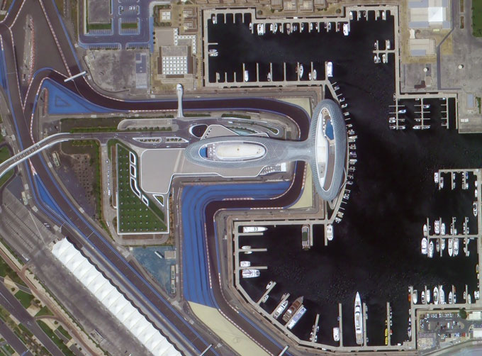
Urban Planning
The application of high-resolution remote sensing data to urban planning analysis is one of the main aspects of remote sensing applications, such as:
Dynamic monitoring of urban construction
Extraction of urban road network
Urban expansion monitoring
Urban environmental monitoring and assessment
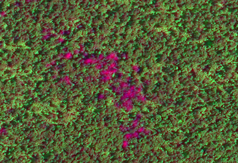
remote sensing in environment
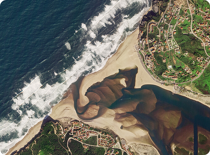
Environment
Remote sensing image has always been a powerful tool for environmental monitoring. Some of the feasible applications are:
Environmental impact assessment for a wide range of projects (natural resources exploitation, infrastructure development, etc)
River/Lake water bodies monitoring
Desertification processes monitoring and mitigation activities
Erosive processes analysis, restoration techniques planning and implementation
agriculture satellite data
Agriculture
There is able to provide data for monitoring, mapping and deriving biophysical parameters and state of agricultural lands. Some of the possible applications are:
Crop spatial distribution
Crop condition monitoring
Agricultural reservation supervision
Agricultural disaster monitoring
Chang GuangSatellite Technology Co., Ltd. is a satellite data companies, we provide satellite china, remote sensing satellite, satellite based remote sensing, aerial satellite services, etc. For more information about types of remote sensing satellitesand satellite remote sensing technology, please feel free to contact us!
Отправить запрос, связаться с поставщиком
Другие товары поставщика
 |
CUBESAT PLATFORM | Cubesat for Sale The cube satellite platform can provide carrying services for the user's payload. 12U Cubesat Platform Non-standard 6U Cubesat... |
 |
SATELLITE GROUND SYSTEMS | The mission of the ground satellitesystem is to track, measure and control the earth resources satellite, implement functional management, and rece... |
 |
PHOTOGRAMMETRY REMOTE SENSING | Photogrammetry remote sensingis to obtain reliable information about the earth, its environment and other natural objects and processes by using sa... |
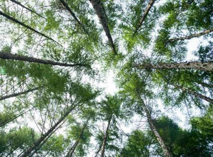 |
REMOTE SENSING IN FORESTRY | Applications of remote sensing in forestry Remote sensing in forestryis a technology that uses the inherent characteristics of electromagnetic wav... |
 |
PUSH BROOM SCANNING SERVICE | The massive imagery archieved data and task programming data that cover all over the world captured by Jilin 1constellation. Great view and great d... |
Похожие товары
 |
PHOTOGRAMMETRY REMOTE SENSING | Продавец: Chang Guang Satellite Technology Co., Ltd. | Photogrammetry remote sensingis to obtain reliable information about the earth, its environment a... |
 |
MARINE REMOTE SENSING | Продавец: Chang Guang Satellite Technology Co., Ltd. | MARINE REMOTE SENSING Ocean colour remote sensingrefers to remote sensing that takes the ocean a... |
 |
NIGHT SATELLITE IMAGE | Продавец: Chang Guang Satellite Technology Co., Ltd. | The SP and GF03C satellites of JL1 constellection can conduct fast shooting with high-resolutions... |
 |
MULTISPECTRAL IMAGES IN REMOTE SENSING | Продавец: Chang Guang Satellite Technology Co., Ltd. | Multispectral remote sensing refers to the multispectral data remote sensingtechnology that divid... |
 |
MULTI SPECTRAL IMAGERY | Продавец: Chang Guang Satellite Technology Co., Ltd. | The GP satellites of JL1 constellection have 26 spectral channels, covering optical remote sensin... |


