


REMOTE SENSING IN ENVIRONMENT


Satellite Environmental Monitoring
Remote sensing in environmentis a general term for monitoring, evaluating and forecasting the dynamic changes of the natural and social environment by using various remote sensing technologies. Environmental remote sensing can quickly provide reliable basis for environmental monitoring, evaluation and prediction.
MAIN PRODUCT SYSTEM CONTENTS OF ENVIRONMENTAL PROTECTION REMOTE SENSING SERVICE OF CGSTL
|
Product name |
Service frequency |
|
|
1 |
Bare soil dust source monitoring product |
Basic: Once a month |
|
Customized: On demand |
||
|
2 |
Straw incineration and full quantitative disposal monitoring product |
Straw burning:10 times/minute |
|
Straw removal/burning:2-3 times/month |
||
|
3 |
Urban and rural black-smelly water pollution monitoring product |
Basic: Once a quarter |
|
Customized: On demand |
||
|
4 |
Irregular solid waste stacking monitoring product |
Basic: Once a month |
|
Customized: On demand |
||
|
5 |
Ecological protection warning line monitoring product |
Basic: Once a quarter |
|
Customized: On demand |
If you want to get co2 emissions monitoringdata, please visit our website.
ChangguangSatellite Technology Co., Ltd. ( CGSTL), founded on December 1st, 2014, it's a unique commercial aerospace enterprise with the development and operation of commercial satelliteresearch, management as well as remote sensing information processing all in one. With a total registered capital of 1.97 billion RMB, the company comprises Jilin Provincial Government, Changchun Institute of Optics, Fine Mechanics and Physics (CIOMP), social capital, and technical backbone.
Send product request
Other supplier products
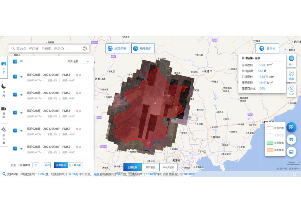 |
SATELLITE DATA MANAGEMENT | DATA MANAGEMENT SYSTEM SATELLITE DATA MANAGEMENT FEATURES 1 The data management system is the center of the storage, management and applicatio... |
 |
SATELLITE PRODUCTS | Satellite Communication Products Jilin1satellite constellation is the core project of CGSTL. It is composed of 138 high-performance optical remo... |
 |
CUBESAT PLATFORM | Cubesat for Sale The cube satellite platform can provide carrying services for the user's payload. 12U Cubesat Platform Non-standard 6U Cubesat... |
 |
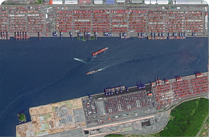
PUSH BROOM SCANNING SERVICE | The massive imagery archieved data and task programming data that cover all over the world captured by Jilin 1constellation. Great view and great d... |
 |
CUSTOMIZED SATELLITE TESTING SERVICE | Custom Satellite Solutions Jilin satellitecan provide customized remote-sensing information services to meet your specific needs. FEATURES OF CUS... |
Same products
 |
PHOTOGRAMMETRY REMOTE SENSING | Seller: Chang Guang Satellite Technology Co., Ltd. | Photogrammetry remote sensingis to obtain reliable information about the earth, its environment a... |
 |
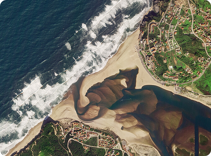
MARINE REMOTE SENSING | Seller: Chang Guang Satellite Technology Co., Ltd. | MARINE REMOTE SENSING Ocean colour remote sensingrefers to remote sensing that takes the ocean a... |
 |
NIGHT SATELLITE IMAGE | Seller: Chang Guang Satellite Technology Co., Ltd. | The SP and GF03C satellites of JL1 constellection can conduct fast shooting with high-resolutions... |
 |
MULTISPECTRAL IMAGES IN REMOTE SENSING | Seller: Chang Guang Satellite Technology Co., Ltd. | Multispectral remote sensing refers to the multispectral data remote sensingtechnology that divid... |
 |
MULTI SPECTRAL IMAGERY | Seller: Chang Guang Satellite Technology Co., Ltd. | The GP satellites of JL1 constellection have 26 spectral channels, covering optical remote sensin... |


