


SATELLITE IMAGE PROCESSING TECHNIQUES


SATELLITE IMAGE PROCESSING TECHNIQUES
SATELLITE IMAGE ACQUISITION SYSTEM
SATELLITE IMAGES FOR IMAGE PROCESSINGFEATURES
1
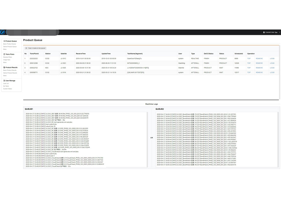
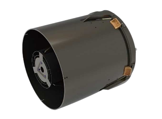
Satellite image processingsystem is the core of preprocessing of satellite imagesafter landing.
2
The system decrypts and decompresses the received original code stream data, completes the analysis and processing of auxiliary data, and then catalogues the data.
If you want to know more details of image processing of satellite images, please visit our website.
CGSTL (ChangguangSatellite Technology Co., Ltd) is the first commercial remote sensing satellitesupplier in China. Now, CGSTL has set up a commercial business dealing with the development and operation of commercial satellites as well as remote sensing information processing all in one.
Send product request
Other supplier products
 |
MARINE REMOTE SENSING | Oceanographic Applications of Remote Sensing Ocean color remote sensing refers to remote sensing that takes the ocean and coastal zone as the moni... |
 |
Satellites Data Service | At present, JL1 constellation has 72 on-orbit satellites in space and more than 5,000,000 square kilometers of new shooting area in the world are a... |
 |
SATELLITE CAMERAS | Satellite Cameras Specialized devices that take high-quality images from space. 5m-resolution Multispectral Camera 2m-resolution Micro-nano Came... |
 |
SATELLITE CAMERAS | Satellite Cameras Specialized devices that take high-quality images from space. 5m-resolution Multispectral Camera 2m-resolution Micro-nano Ca... |
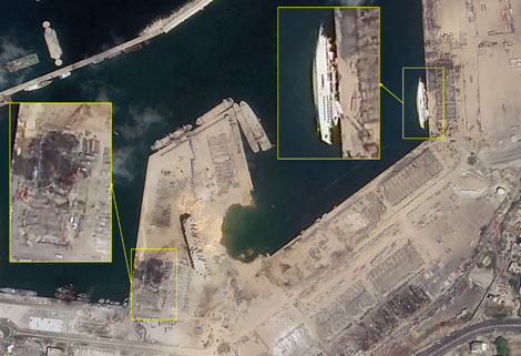 |
SATELLITE IMAGE MONITORING | Change remote sensing monitoringuses multi-temporal remote sensing data, a variety of image processing and pattern recognition methods to extract c... |
Same products
 |
PHOTOGRAMMETRY REMOTE SENSING | Seller: Chang Guang Satellite Technology Co., Ltd. | Photogrammetry remote sensingis to obtain reliable information about the earth, its environment a... |
 |
MARINE REMOTE SENSING | Seller: Chang Guang Satellite Technology Co., Ltd. | MARINE REMOTE SENSING Ocean colour remote sensingrefers to remote sensing that takes the ocean a... |
 |
NIGHT SATELLITE IMAGE | Seller: Chang Guang Satellite Technology Co., Ltd. | The SP and GF03C satellites of JL1 constellection can conduct fast shooting with high-resolutions... |
 |
MULTISPECTRAL IMAGES IN REMOTE SENSING | Seller: Chang Guang Satellite Technology Co., Ltd. | Multispectral remote sensing refers to the multispectral data remote sensingtechnology that divid... |
 |
MULTI SPECTRAL IMAGERY | Seller: Chang Guang Satellite Technology Co., Ltd. | The GP satellites of JL1 constellection have 26 spectral channels, covering optical remote sensin... |


