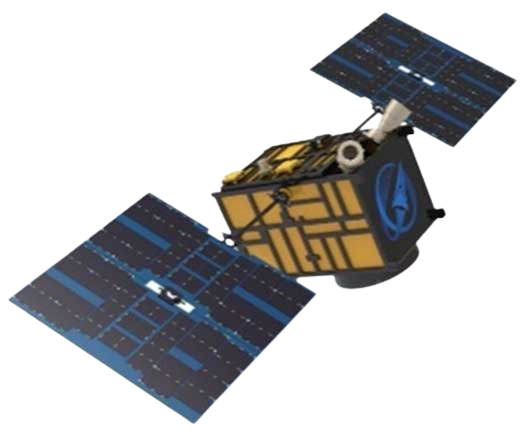
JL1 Satellite Manufacturing Product


Based on "the integration of satellite-borne" and other core technologies, CGSTL has set up the commercial business dealing with the development and operation of satelliteand remote sensing information processing all in one.
REVOLUTIONARY JL1 SATELLITE INDUSTRIES PRODUCTS
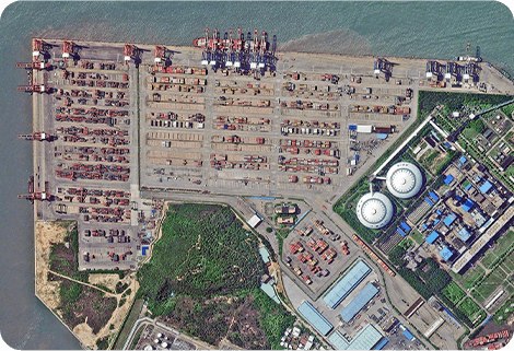
HIGH-QUALITY REMOTE SENSING INFORMATION
High-quality Remote Sensing Information
Jilin-1 satellite constellation can visit any place in the world 23 to 25 times a day, with the ability to update a global map twice a year and a national map 6 times a year.
STRONG SERVICE ABILITY
Strong Service Ability
Jilin-1 satellite constellation can produce services for agricultural and forestry production, environmental monitoring, smart city, geographical mapping, land planning, and other fields.
BROAD AND STABLE BUSINESS
Broad and Stable Business
The main business covers satellite development, satellite in-orbit delivery, satellite component development, UAV development, UAV component development, mapping services and remote sensing advanced products, industry application solutions, ground application systems, large data application services, etc.
Chang Guang Satellite Technology Co., Ltd. is a satellite manufacturing companies, we provide satellite industries products, satellite manufacturing, satellite communication service, etc. For more information, please feel free to contact us!
在线联系供应商
Other supplier products
 |
SATELLITE IMAGE VIDEO | Satellite Image Video The SP, GF03C and MF satellites of JL1 constellection can gaze at a single target point for 120 seconds at most to record ... |
 |
MULTISPECTRAL IMAGES IN REMOTE SENSING | Multispectral Remote Sensing Applications hyperspectral and multispectral remote sensingrefers to the remote sensing technology that divides the e... |
 |
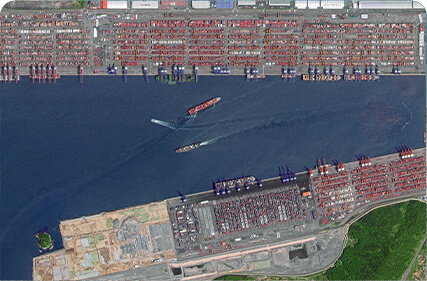
SATELLITE IMAGE MONITORING | Change remote sensing monitoringuses multi-temporal remote sensing data, a variety of image processing and pattern recognition methods to extract c... |
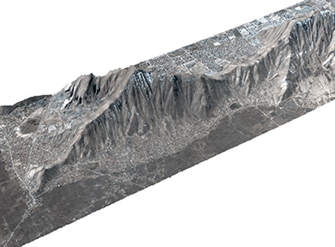 |
STEREO SATELLITE DATA | The data of SP or GF satellites of JL1 constellection can be used as stereoscopic mapping to produce DSM results with resolution better than 1m. ... |
 |
Satellites Data Service | At present, JL1 constellation has 72 on-orbit satellites in space and more than 5,000,000 square kilometers of new shooting area in the world are a... |
Same products
 |
PHOTOGRAMMETRY REMOTE SENSING | 卖方: Chang Guang Satellite Technology Co., Ltd. | Photogrammetry remote sensingis to obtain reliable information about the earth, its environment a... |
 |
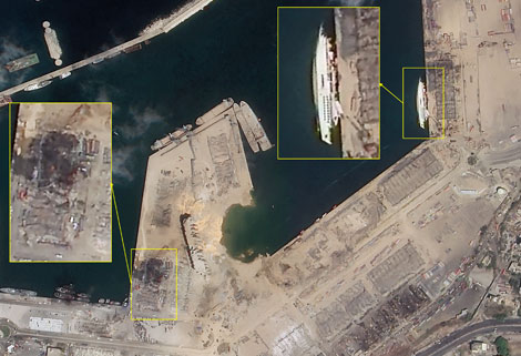
MARINE REMOTE SENSING | 卖方: Chang Guang Satellite Technology Co., Ltd. | MARINE REMOTE SENSING Ocean colour remote sensingrefers to remote sensing that takes the ocean a... |
 |
NIGHT SATELLITE IMAGE | 卖方: Chang Guang Satellite Technology Co., Ltd. | The SP and GF03C satellites of JL1 constellection can conduct fast shooting with high-resolutions... |
 |
MULTISPECTRAL IMAGES IN REMOTE SENSING | 卖方: Chang Guang Satellite Technology Co., Ltd. | Multispectral remote sensing refers to the multispectral data remote sensingtechnology that divid... |
 |
MULTI SPECTRAL IMAGERY | 卖方: Chang Guang Satellite Technology Co., Ltd. | The GP satellites of JL1 constellection have 26 spectral channels, covering optical remote sensin... |