Satellites Data Service


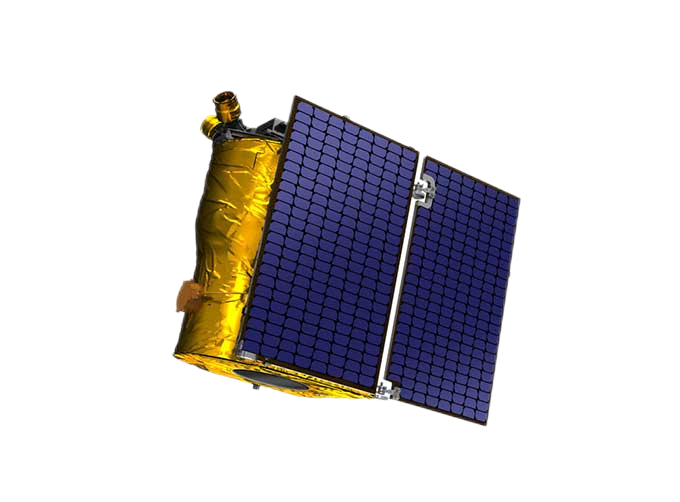
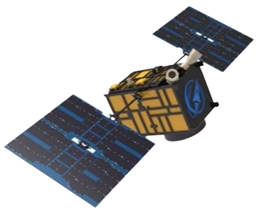
At present, JL1 constellation has 72 on-orbit satellites in space and more than 5,000,000 square kilometers of new shooting area in the world are added every day.
SATELLITES DATA SERVICE-A NEW WAY TO OBSERVE OUR PLANET
Archived data
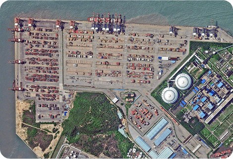
The satellite data servicerefers to providing users with archive remote sensing data query and download services. Users can query the archived data of JL1 satellite constellation at all levels through the online distribution platform or API interface calling, and then users can submit the data requirements as needed. The imagery datawill be delivered to users through the public cloud platform within the specified time.
Task programming
Task programming refers to providing users photography service with the ability of JL1 satellite constellation. Users can submit future-oriented point/area shooting requirements. After responding to the requirements, JL1 Measurement and Operation Control Center plans shooting task and data production within a specified period. Users will receive the entity data through the public cloud platform within the specified time.
Base map basic data service
BaseMap basic data service refers to publishing the data of a specific area and a specific time range into an online map service after mosaic and slicing, which is provided to users or various business systems for direct reference. The basic data of a map is tile data with 3 spectra and 8 bits.
Chang GuangSatellite Technology Co., Ltd. is a satellite data companies, we provide satellite data products, satellite data system, aerial satellite services, etc. For more information about types of satellite data products, please feel free to contact us!
Send product request
Other supplier products
 |
PUSH BROOM SCANNING SERVICE | The massive imagery archieved data and task programming data that cover all over the world captured by Jilin 1constellation. Great view and great d... |
 |
MULTISPECTRAL IMAGES IN REMOTE SENSING | Multispectral Remote Sensing Applications hyperspectral and multispectral remote sensingrefers to the remote sensing technology that divides the e... |
 |
STEREO SATELLITE DATA | The data of SP or GF satellites of JL1 constellection can be used as stereoscopic mapping to produce DSM results with resolution better than 1m. ... |
 |
SATELLITE PRODUCTS | SATELLITE PRODUCTS Jilin 1 satelliteconstellation is the core project of CGSTL. It is composed of 138 high-performance optical remote sensing sate... |
 |
INSURANCE SATELLITE REMOTE SENSING | Combining satellite and remote sensingtechnologies with rights confirmation data and land parcel segmentation technology can vectorize and spatiali... |
Same products
 |
JL1 Satellite Manufacturing Product | Seller: Chang Guang Satellite Technology Co., Ltd. | Based on "the integration of satellite-borne" and other core technologies, CGSTL has set up the c... |
 |
Satellites Testing Services | Seller: Chang Guang Satellite Technology Co., Ltd. | The satellite communication testing services of CGSTL mainly consist of optical manufacture, sate... |
 |
SATELLITE TESTING SERVICE | Seller: Chang Guang Satellite Technology Co., Ltd. | A key test satelliteprocedure in qualifying a satellite for launch. Component-level Thermal-vacu... |
 |
JL1 Satellite Services | Seller: Chang Guang Satellite Technology Co., Ltd. | The technical index and function mode in terms of satellites research are taking the leading posi... |
|
|
Satellites Data Service | Seller: Chang Guang Satellite Technology Co., Ltd. | At present, JL1 constellation has 72 on-orbit satellites in space and more than 5,000,000 square ... |